How RTK works in a robot mower: accuracy, base stations and limitations
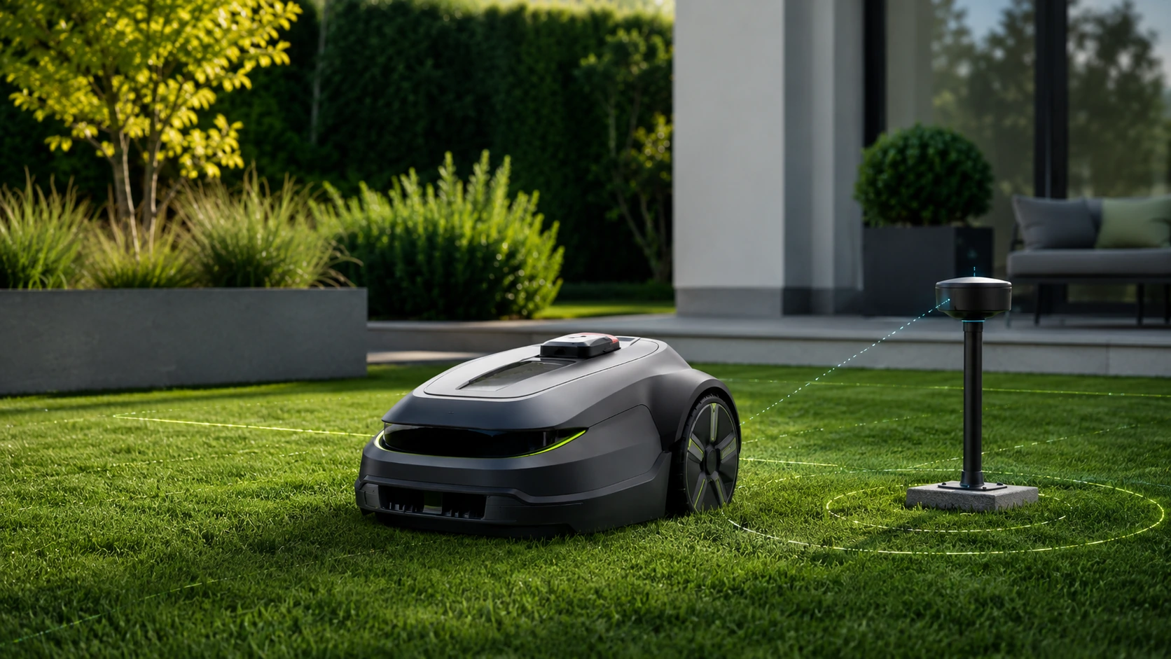
RTK is today one of the most frequently used abbreviations in descriptions of cordless robot mowers. It is often presented as if it alone guarantees a perfect map, even stripes and trouble-free operation in any garden. This is an oversimplification.
RTK does not replace satellite navigation. Is method correcting its errors. The robot still receives GNSS signals, but compares them with data from a point with precisely known position. Thanks to this, it can reduce the typical error from a few meters to a level that allows the device to be guided close to the virtual boundary.
In practice, the quality of operation depends not only on the "RTK" inscription on the housing, but also on the antenna, the method of providing corrections, sky visibility, software and sensors supporting positioning.
Short answer: what is RTK?
RTK, or Real-Time Kinematic, uses current correction data to correct the position calculated from satellite signals. The robot receives information about the error occurring at a given time and place, and then takes it into account when determining its own coordinates.
The correction data can come from:
- local reference station set at home;
- network of permanent reference stations sending corrections via the Internet;
- manufacturer's or external operator's infrastructure;
- a hybrid solution in which RTK is only one of several position sources.
The correction itself does not recognize a toy, dog or discount. This requires cameras, LiDAR, crash sensors or other perception systems.
Why isn't regular GNSS enough?
The phone can indicate that you are in front of the house, but the robot mower must know whether it is 15 centimeters from the flowerbed or already in it. The standard satellite position may be subject to errors resulting from, among others:
- signal delays in the atmosphere;
- satellite orbit and clock inaccuracies;
- reflect signal from walls, roof and other surfaces;
- unfavorable satellite system over the garden;
- parts of the sky obscured by trees and buildings;
- the quality of the receiver and antenna in the device.
The error is not permanent. It may change over time, so "calibrating the GPS" once is not enough.
How does RTK work step by step?
1. The robot receives signals from satellites
The GNSS receiver on the robot measures signals from multiple satellites and calculates its approximate position. The better the geometry of the visible satellites, the easier the task.
2. The reference station does the same
The reference station also receives satellite signals. Its true coordinates are known, so the system can compare the calculated position with the actual position and estimate the current error.
3. The correction goes to the robot
In a local system, the home station communicates with the robot directly or through the manufacturer's infrastructure. In Network RTK, data comes from the CORS station network and arrives via the Internet, Wi-Fi or cellular communication.
4. Robot determines corrected position
The receiver combines its own measurements with correction. Given the right conditions, it can obtain a position accurate enough to follow planned lines and respect the digital boundary.
5. The software compares the position with the map
Boundaries, work zones, passages and prohibited areas are saved in the application. The robot constantly checks where it is relative to this map.
Local antenna or Network RTK?
Local Reference Station
In this variant, the user installs the antenna on the plot. Its advantage is the short distance from the robot and control over the installation site. The disadvantage is the need to find a point with good visibility of the sky, supply power and install it correctly.
Moving the antenna after mapping may require reconfiguration. A station placed under an eaves, next to a metal structure or under a tree crown will not fully utilize its capabilities.
Network RTK
Network RTK uses multiple fixed reference stations. Corrections are calculated centrally and sent to the robot via the Internet. The user does not have to mount the antenna on the property, but the system becomes dependent on:
- service coverage in a given location;
- internet or mobile connection;
- manufacturer's data policy;
- length of free service period;
- continue to maintain the infrastructure.
Kress describes a system based on the CORS network, and Segway and Mammotion offer network corrections without a local antenna on selected models. Before purchasing, you need to check the coverage at a specific address, and not just the presence of functions in the specification.
What does "centimeter accuracy" really mean?
This is a declaration of the system's capabilities under appropriate conditions, not a promise that the robot housing will never deviate from the boundary by more than a few centimeters.
The final travel path is also influenced by:
- wheel play and slippage;
- ground slope;
- wet or muddy grass;
- measurement filtering method;
- robot speed;
- boundary mapping quality;
- safety margin set by the manufacturer;
- position of the cutting disc relative to the receiver and housing.
Therefore, the accuracy of the coordinates should not be equated with the width of the uncut strip near the wall.
Why does RTK have problems under trees and against walls?
RTK does not create a satellite signal. If the receiver sees too little sky or receives many reflected signals, correction will not solve the entire problem.
Difficult places include:
- the space between the tall house and the hedge;
- lawn under a dense crown of old trees;
- narrow strip next to metal fence;
- driveway between buildings;
- charging station hidden deep under the roof.
The robot should then safely slow down, switch to other position sources, or abort the task. The worst behavior would be to continue driving in an uncertain position.
Why does RTK connect to camera, LiDAR and odometry?
Modern robots rely less and less on a single sensor. Hybrid system can connect:
- RTK or regular GNSS;
- cameras recognizing borders and landmarks;
- LiDAR measuring ambient geometry;
- IMU measuring rotation and acceleration;
- odometry, i.e. information about wheel movement;
- ultrasonic and crash sensors.
Kress describes maintaining position under trees using V-SLAM, IMU and odometry. Mammotion combines NetRTK with a set of cameras in selected models, and the ECOVACS and Dreame systems show that the robot can also localize without RTK, using LiDAR and image.
Sensor fusion does not mean complete fault tolerance. However, it means that the loss of one source of information does not have to immediately deprive the robot of its orientation.
How is a virtual boundary created?
Most often, the user guides the robot along the edge using remote control or allows the device to perform automatic mapping. The saved points form a polygon representing the mowing zone.
A good application should be able to:
- corrected only part of the border;
- create a straight line between points;
- adding forbidden zone;
- setting transport corridor;
- recording of several zones and schedules;
- preview of signal quality during mapping;
- safe stop on loss of position.
It is worth creating a map when reception conditions are good and after removing temporary obstacles. A border that is not precisely drawn will remain inaccurate even with great RTK.
How to set the station and antenna?
The specific manufacturer's instructions always apply, but the general principles are similar:
- choose a place with as wide a view of the sky as possible;
- avoid metal roofs and walls directly next to the antenna;
- check if the robot has a stable signal also when docking;
- do not install the station in the narrowest, most shaded part of the plot;
- after creating the map, do not move the antenna without checking the procedure;
- ensure stable mounting and power supply;
- verify Network RTK coverage before purchasing.
What failures are typical for an RTK system?
- loss of network adjustments;
- no cellular or Wi-Fi;
- satellite visibility deterioration;
- local antenna offset;
- boundary incorrectly written;
- software update changing behavior;
- strong wheel slippage causing divergence between position and track;
- fallback mode without clear information to the user.
It is worth checking whether the robot saves diagnostic messages and shows in the application whether it is working in full RTK, approximate position or vision system.
Does RTK require a subscription?
There is no single rule. A local station usually does not need an external correction network, although the application and remote functions can use the Internet. Network RTK can be free for life, for a set number of years, or under terms that may be updated by the manufacturer.
Please check separately before purchasing:
- cost of RTK corrections;
- 4G transmission cost;
- free period length;
- basic functionality after completion;
- able to use via Wi-Fi;
- service availability in Poland.
For which garden is RTK a good choice?
RTK is best suited to a garden where:
- most of the lawn has a good view of the sky;
- boundaries change frequently;
- multiple zones exist;
- regular mowing strips needed;
- user wants to easily create temporary bans;
- narrow and shaded areas are few or the robot has an effective hybrid system.
In a very shady, old garden, a stable boundary wire or a LiDAR/vision system may be more rational than purchasing a device based almost entirely on satellites.
RoboMorrow Request
RTK is a very useful technology, but should not be evaluated in isolation from overall navigation. The most important question is not "does the robot have RTK?", but:
What will the device do if the RTK is not sure of its position for several dozen seconds?
The answer separates mature systems from devices that only look good in the specifications table.
FAQ
Does RTK work without internet?
The local station can transmit corrections without an external network, but the details depend on the manufacturer. Network RTK, by definition, needs a channel through which corrections will reach the robot.
Does RTK work under trees?
May work, but dense corona impairs reception and increases the risk of signal reflections. Systems that support RTK with a camera, LiDAR, IMU and odometry perform best.
Do you need to have an antenna on the roof?
Not always. Some robots use a local station, others use Network RTK without an antenna on the property. The local antenna does not have to be on the roof, but it does need a location as specified in the instructions.
Is RTK more accurate than wire?
RTK gives you accurate position and flexible map. The wire creates a stable physical boundary. In an open garden, RTK may be more convenient, and under dense trees, the cable may prove more predictable.
Do I need to map the garden again after moving the station?
Often yes or at least perform the relocation procedure. Do not assume that the map will automatically adjust to a new antenna or station position.
Does centimeter accuracy mean no trimmer adjustments?
No. The amount of edge grass also depends on the enclosure design, drive position, edge type, and safety margins.
Does RTK recognize obstacles?
No. RTK tells the robot where it is. Obstacle recognition requires different sensors and algorithms.
Is Network RTK always free?
No. Terms vary between brands and models. You need to check the price of corrections, data transmission and the free access period.
Related materials
- Cable-free robot mower: RTK, Vision or LiDAR?
- RTK or boundary wire?
- Vision AI or RTK in a robot mower?
- Robot Mowers 2026: The Complete Guide
Sources and verification date
Product parameters and examples checked on August 2, 2026 in official manufacturer materials:
- https://www.kress.com/en-gb/kress-eyepilot-rtk%E2%81%BF-1000-m%C2%B2-robotic-lawn-mower-with-zerotrim-integrated-4g-kr261es/
- https://www.husqvarna.com/uk/support/husqvarna-self-service/set-up-and-manage-work-areas-stay-out-zones-and-transport-paths-with-epos-wire-free-technology-ka-70385/
- https://eu.mammotion.com/products/luba-mini-2-awd-1000-robot-lawn-mower
- https://navimow.segway.com/pages/navimow-i-specs
Related Tabs in Robot Database
Check verified model cards associated with this advisory. Product price, availability and status are updated separately in the Robot Database.
- MAMMOTION YUKA mini 2 800
- MAMMOTION LUBA 3 AWD 3000
- SEGWAY NAVIMOW i210 LiDAR Pro
- HUSQVARNA Automower 410VE NERA
- GARDENA smart SILENO free 800
- ECOVACS GOAT O800 RTK
See the entire Robot Database →
Where to buy models from this article
We show only exact verified Amazon product pages. Before purchase, confirm the variant, seller, warranty and box contents.
Exact Amazon links. Where a verified RoboMorrow marketplace tracking ID is active, the link is an affiliate link and we may earn from qualifying purchases. Price and availability can change after you click.