Robot mower under trees and weak RTK: when does LiDAR help?
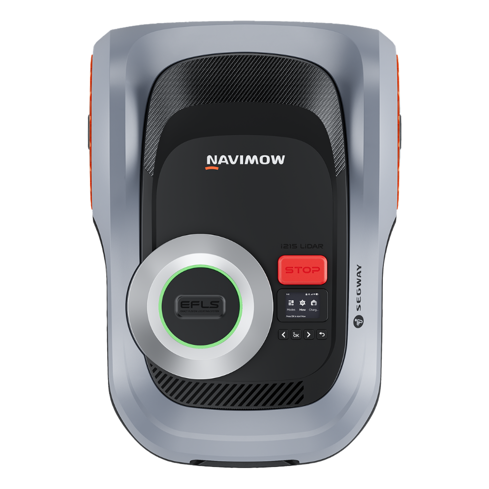
If a robot mower loses position under trees, the mower itself is not always the only problem. Dense canopy, a house wall, narrow passage, metal fence and tall buildings can degrade GNSS geometry. In 2026, manufacturers address this with Network RTK, computer vision and LiDAR. The most sophisticated machines combine several methods, but more sensors do not automatically mean better performance in every lawn.
This guide is for gardens with mature trees, shade or areas where conventional RTK becomes inconsistent. We explain when LiDAR is genuinely useful, when Network RTK + Vision is enough, and when changing base placement or the route matters more than buying a more expensive mower. The Navimow i2 family is a useful case study because Segway offers AWD, LiDAR and LiDAR Pro architectures in parallel.
Under trees, test position loss rather than the technology logo
Updated 16 September 2026. “LiDAR” and “RTK” are not a simple better/worse table. The useful question is what the mower does when its primary localisation source degrades for several seconds. A strong system should slow or stop safely, use supporting signals and recover position without routine human rescue.
- Dense canopy: repeat passes directly under the trees, not only on the open lawn.
- Tall wall: test along the building and in corners where GNSS geometry can be poorest.
- Narrow corridor: evaluate localisation and turning room — physical body width is not enough.
- Soft slope: positioning and traction are separate problems; LiDAR does not replace AWD.
For 300–500 m² gardens combine this test with the 500 m² guide. For two contrasting architectures see GOAT O500 vs Navimow i205 AWD.
Why trees make positioning harder
GNSS works best with good geometry from multiple satellites. Dense canopy does not simply “turn GPS off”, but it attenuates and reflects radio signals. High walls and narrow strips between buildings can create similar multipath effects. Traditional RTK also depends on corrections from a local reference station; a poorly placed antenna can therefore make the whole system start from weaker geometry.
Network RTK moves some infrastructure out of the garden: corrections arrive from a network rather than a user-installed local antenna. That simplifies installation, but it does not mean the mower no longer needs useful positioning data. This is why modern systems combine NRTK with cameras, odometry and additional ranging sensors.
What does vision add?
Vision can identify obstacles, edges and visual features that help a mower understand where it is relative to the environment. It works especially well when the scene contains useful features and lighting is good. It is not a magical replacement for every other sensor. Wet lenses, darkness, uniform surfaces or a heavily changed environment can reduce confidence.
Navimow i2 AWD combines Network RTK with VisionFence. Segway claims centimetre-level positioning and recognition of more than 150 obstacle classes. These figures require real-world validation, but the architecture is clear: satellite-based position provides a major reference while vision adds local context.
What does LiDAR add under trees?
LiDAR actively measures distance to surrounding objects and creates a geometric representation of space. It does not require direct satellite visibility, which makes it a natural support layer under trees or beside buildings. Navimow i2 LiDAR uses LiDAR + Vision and Segway promotes wire-free, local-antenna-free mapping. In principle, the mower can use stable geometry around it as part of localization.
LiDAR also has limitations. Gardens change: plants grow, furniture moves, leaves appear and people walk through the scene. A very open lawn with few reference features can actually be easier for GNSS than for purely local geometric localization. The value of LiDAR therefore depends on the garden rather than a generic “LiDAR is better” rule.
Why combine LiDAR, Network RTK and Vision?
The i2 LiDAR Pro uses what Segway describes as triple-fusion LiDAR + Network RTK + Vision. The logic is redundancy. In an open section, satellite-derived positioning can be strong; under canopy, LiDAR and vision can carry more useful local information; odometry connects motion between observations.
The advantage is not that every sensor is perfect all the time. It is that the system has alternatives when one input becomes weaker. That is what RoboMorrow would want to measure in a real i210 Pro test: not a catalogue accuracy number, but how often the mower stops, drifts, remaps or needs a human intervention in the worst parts of a garden.
When can Network RTK + Vision be enough?
One tree does not automatically justify LiDAR. If most of the lawn has open sky, the shaded area is short and Network RTK coverage is strong, i205 AWD or i208 AWD may be more economical. This is especially true if the real constraint is slope or traction rather than positioning.
Before paying for LiDAR, check Network RTK coverage and think carefully about the charging-station location. Many “RTK problems” are made worse by placing infrastructure behind a building, near large metal objects or at the most difficult point of the route.
When does LiDAR make more sense?
- a long lawn strip between a house and a tall hedge;
- large tree canopies covering much of the sky;
- several zones connected by a narrow corridor;
- a desire to avoid installing a local RTK antenna;
- automatic mapping based on real garden geometry;
- regular evening operation when vision alone should not carry the whole task.
For these conditions, i208/i215 LiDAR are logical candidates. If the same garden also contains steep sections and traction problems, the AWD Pro platform becomes easier to justify.
Do not confuse weak positioning with mechanical grip
A mower can fail near a tree for two completely different reasons. It may not know exactly where it is — a localization problem. Or it may know where it is but spin on a wet root, slope or loose surface — a traction problem. LiDAR does not fix wheel slip. AWD does not automatically fix repeated position uncertainty beneath heavy canopy.
Walk the property and mark “weak signal” areas separately from “difficult driving” areas. If the maps overlap, a Pro architecture has the strongest case. If only one problem exists, a less expensive system may be enough.
Narrow passages: the metric marketing pages often hide
In difficult gardens, the limiting factor is often a transition between zones rather than satellite signal itself. Measure gates, grass strips beside the house and spacing between beds. Check whether the mower needs to make a tight turn at the end. Segway promotes Xero-Turn on Pro models to reduce turf damage, but real behaviour still depends on geometry and surface conditions.
A shaded narrow corridor is exactly where combining LiDAR with other positioning sources can have practical value. It should be part of any dealer demo or return-window test.
How to stress-test a mower
Do not begin with the easiest piece of lawn. Define five stress points: densest canopy, narrowest transition, steepest slope, a paving/gravel crossing and the most difficult edge. Observe whether the mower repeats these tasks across several cycles without manual map correction.
Record errors, stops and manual relocations. After a week, the number of interventions is more informative than the marketing sensor list. A mower that requires a human every second run is not meaningfully autonomous for that garden.
Safety still matters beneath trees
LiDAR and vision may improve obstacle detection, but they do not eliminate the need to prepare a garden. Toys, cords, thin branches, nets, tiny animals and open water features remain separate risks. Segway claims more than 200 obstacle categories for i2 LiDAR and more than 150 for i2 AWD, but this is not a guarantee that every object will be detected in every condition.
If children and wildlife use the garden, night mowing is not automatically desirable just because a sensor works in darkness. Hedgehogs and other small animals are more active after dark. Automation should be scheduled to support safety rather than merely maximize operating hours.
Which Navimow architecture fits the signal problem?
Good signal, difficult traction: i205/i208 AWD. Limited sky view with relatively moderate terrain: i208/i215 LiDAR. Weak positioning plus slopes and complex geometry: i210/i220 LiDAR Pro. It is a simplification, but a more useful one than buying by lawn-size number alone.
Does LiDAR pay for itself?
There is no universal financial return from LiDAR. If a less expensive mower completes the whole garden without intervention, extra sensors do not create savings by themselves. The value appears when the technology removes concrete problems: repeated remapping, stops beneath canopy, manual relocation or unfinished zones. Intervention count is therefore a better trial metric than the sensor list.
Checklist before choosing a mower for a tree-covered garden
- measure actual grass rather than total property size;
- mark mature canopy and high walls on a simple garden plan;
- check Network RTK coverage for the postcode;
- measure the narrowest corridor and steepest slope;
- note paving, gravel and exposed-root crossings;
- decide whether antenna-free mapping, traction or both are the real constraints;
- confirm return terms and local service before peak season.
RoboMorrow conclusion
LiDAR is valuable when it solves a positioning and geometry problem, not simply because it is a newer technology. On an open lawn, Network RTK + Vision can be sufficient and cheaper. Under dense canopy, LiDAR reduces dependence on sky view. When that same lawn also has slopes, the Pro combination of LiDAR, NRTK, Vision and AWD is the most logical candidate for a real-world pilot.
Problem-location log: positioning or physical access?
Mark difficult points on a garden sketch. For each attempt, record the app message, mower position, ground condition and assistance given. Stopping at a root does not itself prove signal loss; a positioning message does not establish a traction fault.
| Observation | Separate these factors |
|---|---|
| Turning back or stopping near a tree | Positioning message, physical obstruction and map boundary |
| Wheel slip | Moisture, uneven ground and travel direction |
| Failed travel to another zone | Channel access, turn, mapping and charging route |
Repeat at the same location and record changes. Do not attribute success to LiDAR alone if an obstacle was removed or the station moved at the same time. Agree acceptance of the hardest route with the installer, not only mowing in the open centre.
Sources
Navimow i2 AWD · Navimow i2 LiDAR · Navimow i2 LiDAR Pro · support / Network RTK